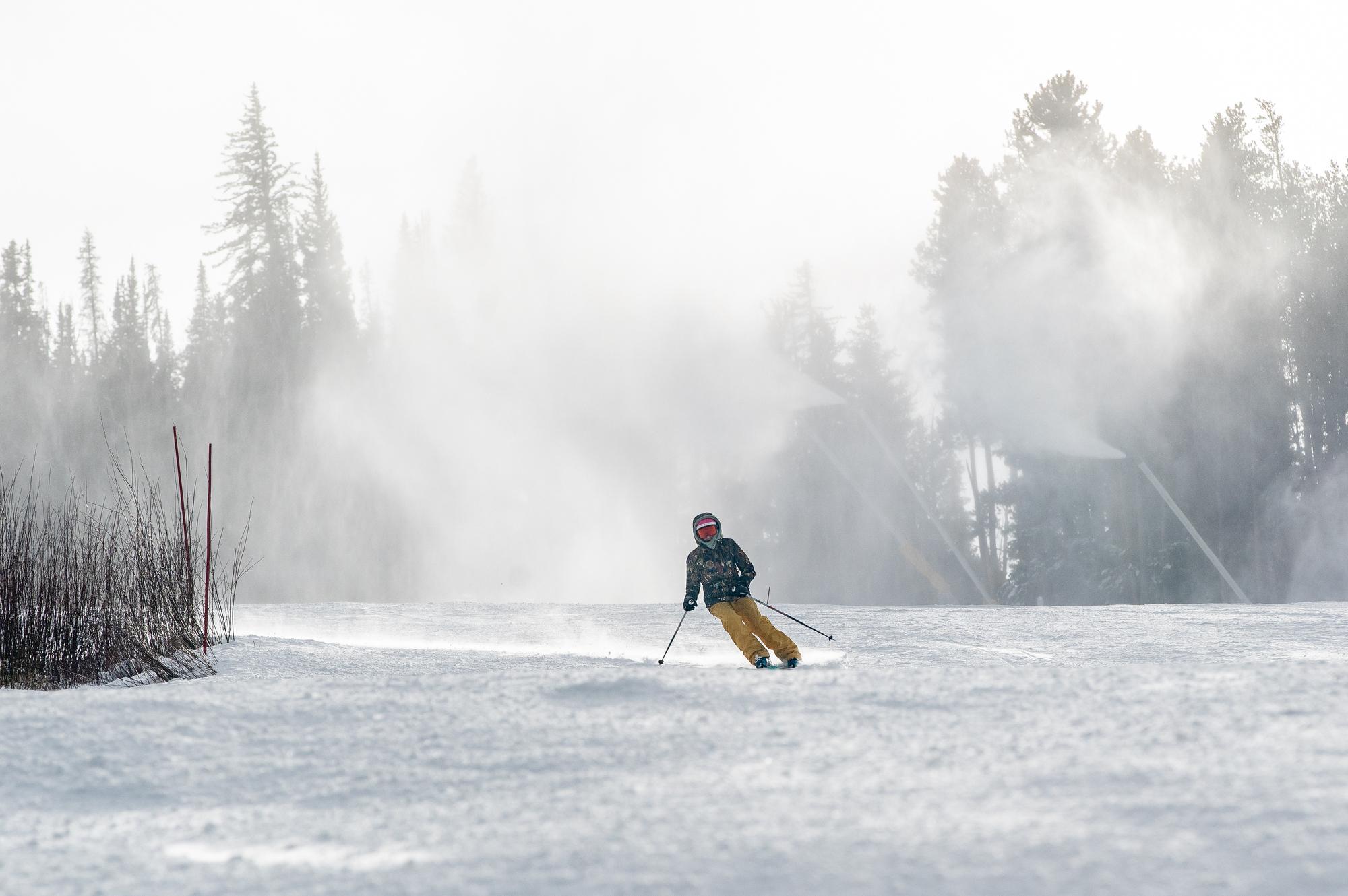
Colorado’s Front Range woke up to its first major winter storm of the season, after snow began falling around 11 p.m. Tuesday.
Most of the metro area is expected to see 2 to 5 inches, but totals climb sharply into the foothills — with parts of Jefferson County already near 8 inches. Farther north, cities like Fort Collins outpaced forecasted expectations, already receiving between 4 to 6 inches of snow.
National Weather Service meteorologist, Kenley Bonner, says the storm is producing a mix of snow types depending on the elevation and temperature.
“In areas where the temperatures are a little bit colder, we’re going to have more of that fluffy, light snow,” Bonner said. “But where temperatures are warmer, it’s leading to that more dense, wet snow that’s heavier.”
According to Bonner, the lighter powder is mostly falling in the foothills and higher terrain, while lower-elevation areas east of the foothills are dealing with wetter, heavier accumulation — the kind that clings to trees and can make driving more difficult.
Despite the impressive snowfall, Bonner says this storm won’t do much for the Western Slope’s water-critical mountain snowpack.
“Unfortunately, this type of upslope event isn’t as beneficial for the higher elevations and the mountains in the western part of the state,” she said.
Still, she says ski areas shouldn’t lose hope.
“All hope is not lost,” Bonner said. “We’re in a favorable pattern moving forward, with persistent chances for mountain snow at least through the beginning of next week — especially for the northern mountains.”
But she said the main concern today remains on the roads. With the season’s first impactful storm underway, winter conditions can catch drivers off guard.
Colorado’s transportation authority has deployed hundreds of snowplows across the Front Range, according to spokesperson Austyn Dineen. And while no major accidents have been reported yet, Dineen says it’s imperative drivers “bow to the plow.”
“It’s paramount that people stay behind snow plows,” Dineen said. “Especially during the evening commute. The pavement is expected to be slick.”
According to Dineen, high mountain travel has been more variable. While the I-70 mountain corridor is seeing mostly routine winter conditions, the southern mountains are experiencing heavier snowfall. Areas around Monarch Pass and Wolf Creek Pass have reported periods of snow falling at two inches per hour, she said.
Those higher rates could create slick and rapidly changing conditions in the central and southern high country through the afternoon and evening. Dineen said drivers heading into those areas should give themselves extra time and check COtrip for real-time road updates — especially as the storm shifts south.
Curious why Denver’s weather measurements come from Denver International Airport? Read here.