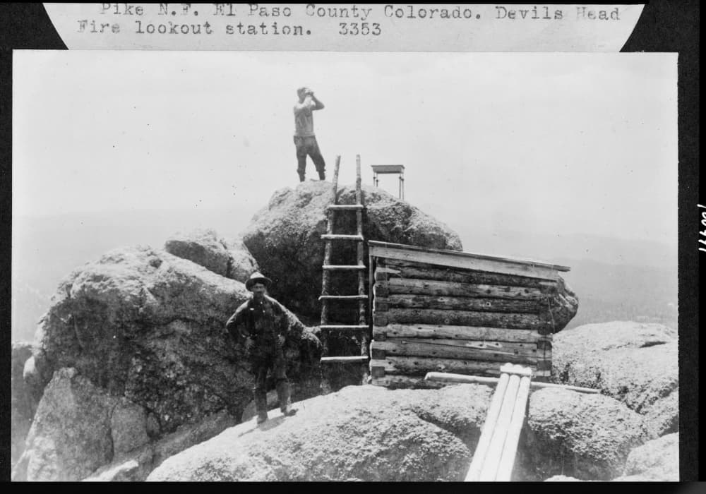
Devil’s Head

For fire-watchers on the Front Range, there may be no better place than Devil's Head. Devil's Head rises 9300 feet west of Castle Rock. It's a ridge of immense granite cliffs, in which some see the horns of Mephistopheles. And at the topmost spot, there's a tiny structure. More than a century ago, the US Forest Service planned a number of fire lookouts between New Mexico and Wyoming; Devil's Head is one of few they actually built. With 100-mile views in every direction to detect the telltale smoke of wildfire, the Devil's Head lookout is still in service, and it’s on the National Register of Historic Places.
To get to this hot spot, take Rampart Range Road to the Devil's Head trail. You’ll hike a mile and a half, then climb 143 red-painted steps to get to the top. Come ready to burn calories.

About Colorado Postcards
Colorado Postcards are snapshots of our colorful state in sound. They give brief insights into our people and places, our flora and fauna, and our past and present, from every corner of Colorado. See more postcards.